Oklahoma Landmen researching land and legal opportunities know how tedious the process can be. Taking hours and hours to search through hundreds of filings and clicking around the Oklahoma Corporation Case Processing system and OAP Orders and Case Files to find the right documents for new and existing orders has always been something you had to do – until now.
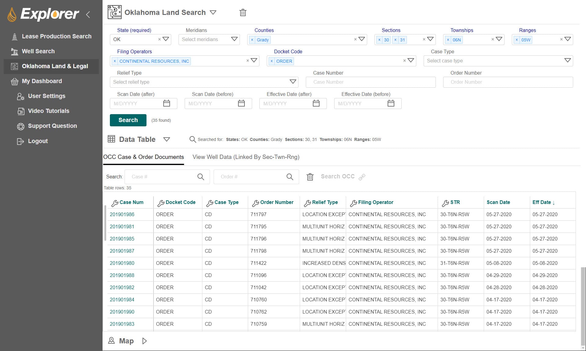
PetroBase Explorer makes it easy to find and cross-reference the necessary OCC case and order documents that you need to build your case for oil and gas drilling or development in Oklahoma.
The software application allows landmen, like yourself, to find more information in less time allowing you to provide accurate information to investors, faster.
The interface is extremely easy to navigate and provides the information you need to know to remain competitive and alert your clients on new filings. Let’s take a closer look at what PetroBase Explorer can do!

Obtaining the necessary information can be time-consuming as documents are not always up to date or just difficult to find. PetroBase Explorer gives you access to case and order files, well spot locations, and highlights land and legal documentation in one place.
Similar to the Case Processing Web Application, Explorer will also let you filter your search based on filing operator, relief type, docket code, or case type. The difference is that PetroBase Explorer is a tool that will reduce the time it takes to cross-reference well data like OCC Well Records (1000 Permits, 1001a Spud, 1002a Completion, 1003c Cement) and production plots against state records.
Location Filters Help You Make Informed Drilling Decisions
Look up orders in specific areas of the state. You can search by county, section, township, and range or see orders and filings within a custom range.
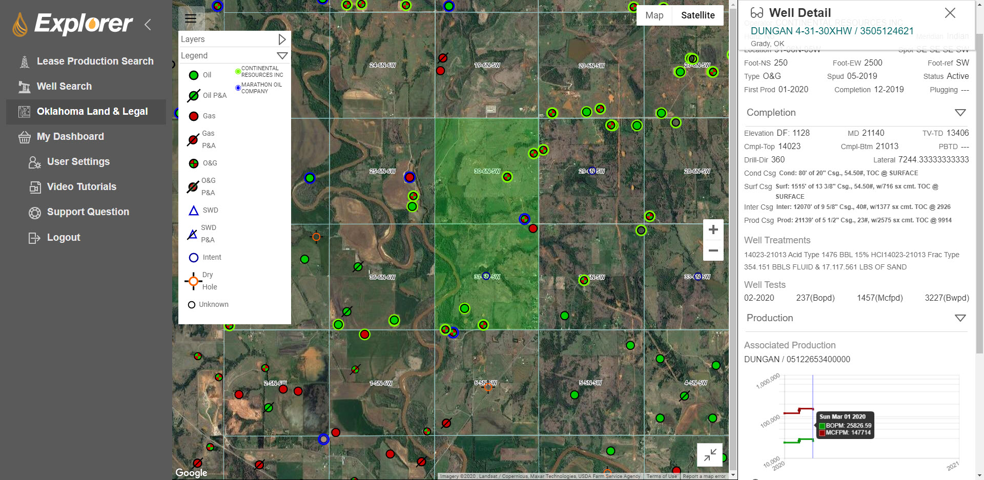
You can view an interactive map of orders in the area of interest and click on each pin to find important well information.
PetroBase Explorer allows users to look up spacing orders in target areas and analyze the specific parameters of force pooling within an interactive and visual interface.

You can also export well data mapping layers to google earth (.kml). This allows you to create well annotations and personalized maps. This feature is extremely beneficial when you are discussing potential opportunities for new oil drilling in Oklahoma.
These personalized maps are also helpful to you as you can go back and reference them when needed.
PetroBase Explorer for Oklahoma Landmen
PetroBase Explorer reduces the time it takes to find case files on an easy to navigate and interactive interface.
Our system also allows users to quickly see:
- Production Rates
- Cumulative Production
- Production Type
- Well Type & Status
- Well Operator
- Zone, County, Section-Township-Range
- Completion Date
- Lease Stop Year
Use the data you gather with Explorer to cross-reference state docs for court filings and give your company the information it needs to make informed decisions.
Get the PetroBase Pro Capabilities Overview
Find out more about the capabiltites and features of PetroBase Pro, and how our software can integrate all of your oil and gas data into one application!

