
PetroBase Explorer Well Data Software
Make quicker, more informed decisions with the ultimate data mining and analysis tool for oil & gas data.
Google Maps Integration
Visualize production and well data with Google Maps integration. Identify trends, patterns and anomalies with a variety of mapping layers. Select a well to instantly view completion information, production and well forms.
Multiple Analysis Options
Make quicker and more informed decisions with a variety of analysis tools. Project future cash flows based on historical oil and gas production data with decline curve analysis, and discover production characteristics with grouped or individual plots.
Areas of Interest
Never miss another well drilling and completion, intent, spud, or transfer! Create areas of interest to receive weekly updates on activities, including but not limited to new state well filings and well completions data.
Get the PetroBase Explorer Capabilities Overview
Find out how PetroBase Explorer makes it easy to find your hidden treasure by putting all of the oil and gas production data at your fingertips.
Through our cloud-based interface, you can easily navigate oil and gas well records and perform highly detailed work with our suite of analysis tools.
What states can this well data software cover?
We currently offer well data packages for Oklahoma, Kansas and Texas.
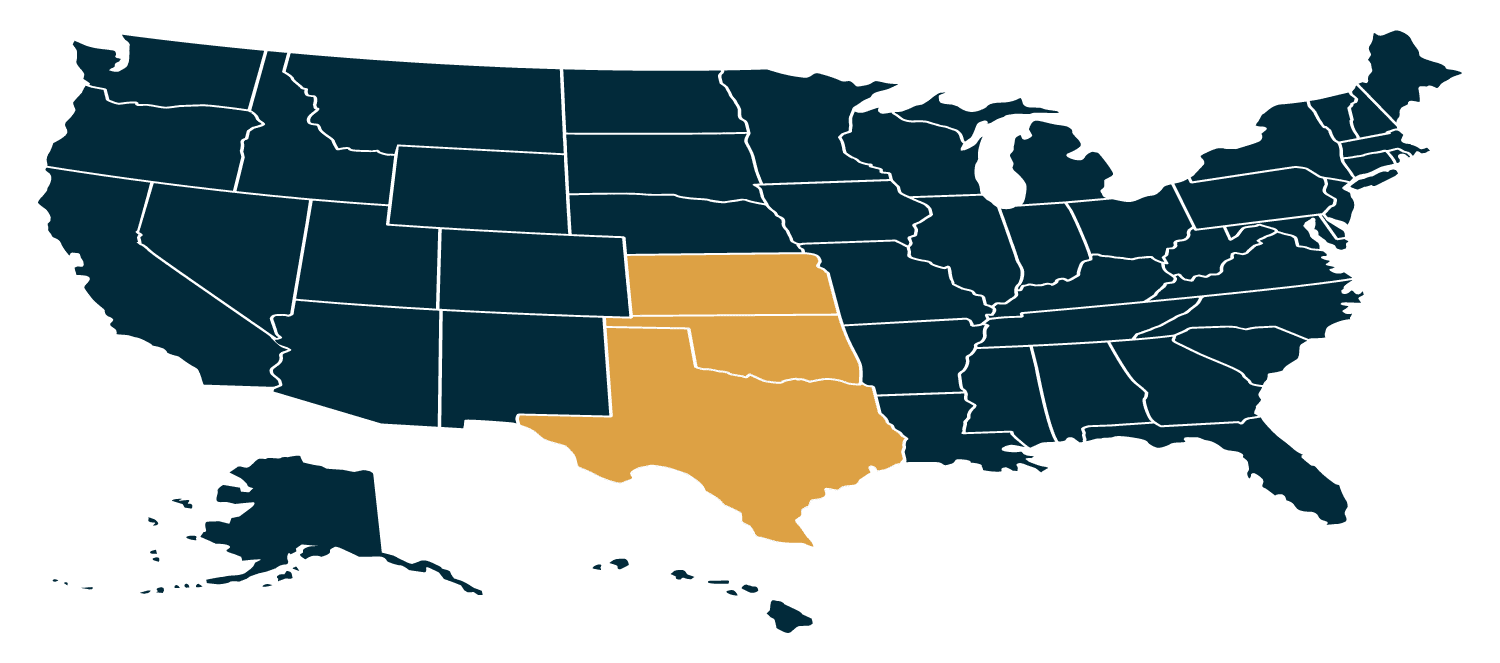
Skip the OCC Well Search and quickly explore and data mine through Oklahoma’s 490,000+ production and well records using advanced search criteria.
Explore and data mine through Texas’ 1.3 million production and well records with ease instead of using the Texas Railroad Commission Well Search.
Who can benefit from PetroBase Explorer well data software?
Explorer derives its well and production data from a variety of sources for users to map, view and analyze. Users can also track new activity and export data to third party software packages. This makes Explorer a valuable data management tool for anyone in the Oil & Gas industry.
E&P Engineers
Office/Field Personnel
Investors and Royalty Owners
Service Companies
The Explorer Advantage
Explorer goes beyond the typical well data software. Here are just a few ways it can help you make data-driven decisions efficiently and effectively.
Generate Oil & Gas Production Plots, Normalized Type Curves, Well Completions Data & Intents Reports, and Many More
Monitor Offsetting Production, Well Completions Data, New Lease Activity, or Well Intents
Monitor offsetting oil and gas production, track new production and well activity, and oil and gas completions. Export well and production data to third party oil and gas software packages. Create areas of interest to receive weekly updates on activity in the areas you want to know about.
Visualize Well Locations & Production Characteristics
Generate well spot locations, well IP maps, production bubble maps, and reference production plots using Google Maps.
Ready to Get Started?